Piter Pass
Blog
The Most Photogenic Bus Stop in Saint Petersburg: the Glass Shelter on Vasilyevsky's Reclaimed Land with a Gulf View

The Most Photogenic Bus Stop in Saint Petersburg: the Glass Shelter on Vasilyevsky's Reclaimed Land with a Gulf View

AS

by Anna Shaposhnikova

5 min readSeptember 08, 2026
🚇Getting Around

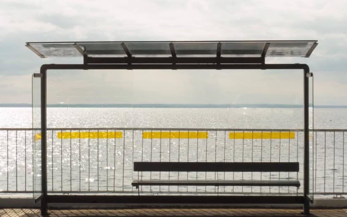
The most photographed bus stop in Saint Petersburg is not in any guidebook. It is an ordinary shelter on Miklukho-Maklaya Embankment, at the western edge of the reclaimed land on Vasilyevsky Island: a glass back wall, a railing with yellow markers behind it, and then nothing but the Gulf of Finland and the sky. The picture works because there is genuinely nothing behind the stop. Here is what the place is, how to get there and when to come for the light.

What it is

The "namyv" is a new district built on land reclaimed from the gulf west of the historic part of Vasilyevsky Island. Its streets are named after explorers: Kruzenshtern Avenue, Lisyansky, Chelyuskin and Chirikov streets, Golovnin Boulevard. The unnamed road along the water, from the Western High-Speed Diameter interchange to Chelyuskina Street, was named Miklukho-Maklaya Embankment in December 2021. It runs along the very edge of the reclaimed land, with the housing behind you, so from the pavement you see open water with no buildings in the frame.

The stop itself, "Naberezhnaya Miklukho-Maklaya", officially appeared on 1 November 2025, when the city transport authority extended two bus routes, 168 and 220, to the embankment and added four new stops along Kruzenshtern Avenue and Chirikova Street. The shelter faces the city with its glass wall towards the gulf, and within months it went viral as "the bus stop with a sea view". In autumn 2025 the embankment was still under construction and buses turned round at Chirikova Street, so older videos may show a different scene.
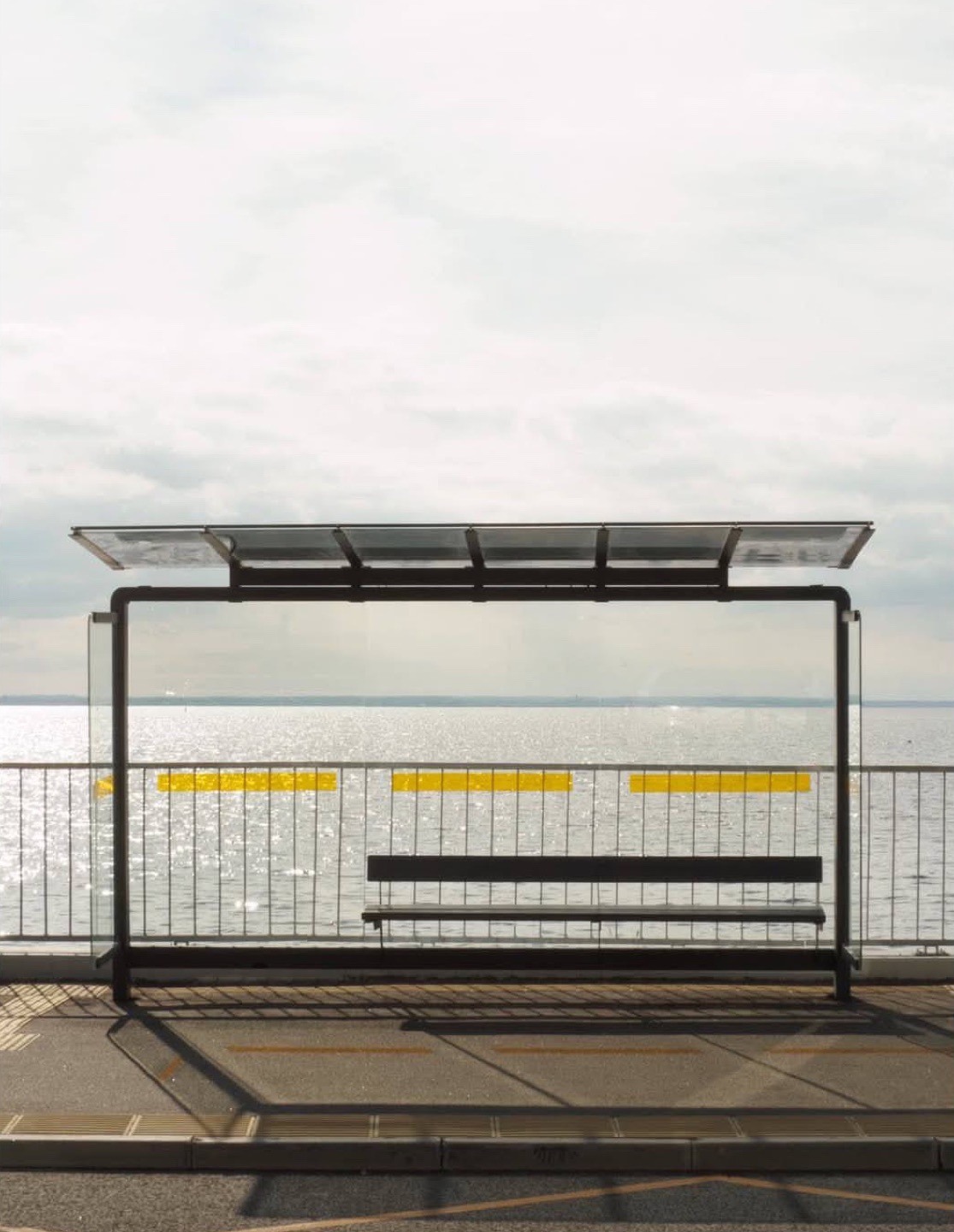
Glass bus shelter on Miklukho-Maklaya Embankment: black frame, a bench, and behind the transparent wall a railing with yellow markers and the Gulf of Finland to the horizon

Getting there

The nearest metro is Primorskaya (green line), about three kilometres away as the crow flies, or roughly forty minutes on foot through the new blocks. The easy way is bus 168 from the Nalichnaya Ulitsa bus station next to Primorskaya metro to its terminus "Naberezhnaya Miklukho-Maklaya", via Kruzenshtern Avenue and Chirikova Street. From Krestovsky Island and the Petrograd Side, bus 220 ends at the same stop. The terminus is the stop in the photographs: step off, turn towards the water and you are in the frame. Timetables for both routes changed in May 2026, so check current intervals in a navigation app.

By taxi or transfer, give the driver "Miklukho-Maklaya Embankment, bus 168 terminus": there are no street addresses on the waterfront yet, and without a hint you will be dropped at the nearest building on Kruzenshtern Avenue. By car, take the Western High-Speed Diameter exit for the Vasilyevsky reclaimed land; parking is on the street along the embankment and scarce on weekend evenings.

When to shoot

The gulf lies to the west, so the light here is an evening light. An hour before sunset the sun drops straight into the water behind the glass and the shelter becomes a black frame around the sky; during the White Nights this stretches into two or three hours of soft light. Mornings are calm and empty, with no glare on the glass, which suits anyone who dislikes queues: on a fine evening people line up for the shot. An overcast day works too, when grey sky and grey water merge and the shelter hangs in a void. The one thing there is always plenty of is wind: the embankment is open to the gulf, bring a jacket even in summer.

Shoot from the far side of the pavement, crouching slightly so the horizon runs through the middle of the glass wall and the railing with its yellow markers sits in the lower third. A phone is enough; on a wide lens keep the verticals straight, because the frame is rectangular and any tilt shows.
Short-term rentals in Saint Petersburg

Лофт у реки Мойки

8 000 ₽ per night · ≈ $93

3 nights · 24 000 ₽ total · ≈ $278

See options

at the Bank of Russia rate on 09.09.2026 · powered by tutkakdoma

What else is on the reclaimed land

The namyv is a residential district rather than a sight: new housing, schools, a clinic, corner shops. Walk along the water: the embankment follows the whole western edge, with cyclists, scooters and locals on benches with coffee. To continue a "sea day", head to Sevkabel Port at the southern tip of the island, the same gulf with cafés, exhibitions and a long promenade. For the island beyond the new blocks, see our local's route around Vasilyevsky Island.

Planning an evening here, remember the bridges: from about one in the morning Vasilyevsky Island is cut off from the centre by the bridge raising, and buses 168 and 220 do not run at night. If you are shooting a June sunset, leave for the centre in time, or know how to cross the Neva at night.

Bus-stop etiquette

This is a working terminus, not a set. When a bus pulls in, give the shelter to passengers and keep off the boarding area. Do not step into the road for a "centre-line" shot and do not climb the railing: the water starts right behind it. A tripod on the pavement bothers nobody; a crew with reflectors at rush hour does.

Frequently asked questions

Where is the bus stop with a view of the Gulf of Finland in Saint Petersburg?

On Miklukho-Maklaya Embankment, at the western edge of the reclaimed land on Vasilyevsky Island, near the Western High-Speed Diameter interchange. It is the terminus of buses 168 and 220.

How do I get to the glass bus stop on Vasilyevsky Island by metro?

From Primorskaya metro take bus 168 from the Nalichnaya Ulitsa bus station to the terminus "Naberezhnaya Miklukho-Maklaya". From Krestovsky Island take bus 220. On foot from Primorskaya it is about three kilometres.

When is the best time to photograph the bus stop on Miklukho-Maklaya Embankment?

In the evening, an hour before sunset: the gulf is to the west and the sun sets behind the glass wall. Mornings are bright and empty; overcast days give a graphic, minimal frame.

When did the "Naberezhnaya Miklukho-Maklaya" stop open?

On 1 November 2025, when bus routes 168 and 220 were extended to the embankment and new stops were added on Kruzenshtern Avenue and Chirikova Street.

Routes and stops per the Saint Petersburg transport authority Organizator Perevozok (extension of routes 168 and 220 to Miklukho-Maklaya Embankment from 1 November 2025; temporary route changes in October 2025); route 168 launch plans per the Transport Committee via MR7, 15 May 2025; the embankment's name per the Toponymic Commission, December 2021; distance to the metro per OpenStreetMap. Photos taken in 2026. Checked 8 September 2026.

Next post

Getting around Saint Petersburg

Airport (Pulkovo) and around-town transfers — fixed price, meet-and-greet driver.

Find a transfer

powered by gettransfer.com

You may be interested

A Child Travelling Abroad from Saint Petersburg: Documents with One Parent, with a Grandparent and Alone — Pulkovo and the Land Border

A Child Travelling Abroad from Saint Petersburg: Documents with One Parent, with a Grandparent and Alone — Pulkovo and the Land Border

With one parent no consent from the other is needed under Russian law as reworded from 20 January 2026. With a grandpare...

Blog
September 08, 2026
Getting to Kronstadt in autumn: the hydrofoils stop, the bus and the dam remain

Getting to Kronstadt in autumn: the hydrofoils stop, the bus and the dam remain

The navigation season ends with the summer. How to reach Kronstadt in autumn and winter — bus 101 from Staraya Derevnya,...

Blog
September 04, 2026
Gulf of Finland Beaches Near Saint Petersburg 2026: Sestroretsk and the Kurortny Coast Guide

Gulf of Finland Beaches Near Saint Petersburg 2026: Sestroretsk and the Kurortny Coast Guide

The northern shore of the Gulf of Finland offers several accessible beach destinations within 40 kilometers of central S...

Blog
July 15, 2026